
|
The Amargosa Canyon is located about 40 miles east of Death
Valley. The canyon begins just south of Tecopa, CA and runs in a southerly
direction for about 9 miles. The Sperry Hills are located within this canyon. Elevations range from 420 meters (1,378
feet) to 695 meters (2,280 feet) at the highest point. |
|
|
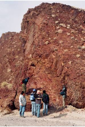
View of the outcrop of the
diamictites. |
Sperry Hills enclose a section of the
Kingston Peak Formation constituted by thick conglomerate beds. The conglomerates that outcrop in Sperry
Hills qualify as diamictites in that they contain a wide range of particle
sizes set in a muddy matrix. Some of the scratched boulders resemble
striated stones in modern glaciers. |
|
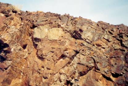
Occasional isolated boulders found in beds
of mudstone or limestone are reminiscent of dropstones from melting icebergs,
settling onto muddy bottoms far from shore. The fact that these dropstones are found in
limestones, provides evidence for a glacio-marine environment existing
probably 600 to 800 million years ago. |
View of the dropstones immerse in a muddy matrix. |
By M. Soledad Velasco
![]()