 | |||||||||||||||||||||||||||||||||||||||||||||||||||||||||||||||||||||||||||
The December 26th 2004, Mw 9.2 Sumatra-Andaman earthquake ruptured 1300–1500 km of the subduction mega thrust along the eastern boundary of the Indian and Australian plates. The nearly 500 km long Andaman segment, the northernmost stretch of the 2004 event, evidenced slower rupture propagation and less slip than other segments. It is the largest event since the 1960s and the first Mw > 9 earthquake to occur in the era of modern space geodesy and broadband seismology.  CARI | HAV2 | HAVE | WNDR | RUTL | RUSW MHRT | JBNK | DGLP | RMNG | INTV | HUTB Field work Photos
Publications:
Slow Slip Acceleration beneath Andaman Islands Triggered by the 11 April 2012 Indian Ocean Earthquakes, Paul, J., K. Rajendran and C.P. Rajendran, Bulletin of the Seismological Society of America, May 2014 Andaman postseismic deformation observations: Still slipping after all these years, Paul, J., C.P. Rajendran, A.R. Lowry, V. Andrade and K. Rajendran, Bulletin of the Seismological Society of America, Vol. 102, No. 1, pp. 343–351, February 2012, doi: 10.1785/0120110074 Significant Motions between GPS Sites in the New Madrid Region: Implications for Seismic Hazard, Frankel, A., R Smalley Jr, and J. Paul, Bulletin of the Seismological Society of America, Vol. 102, No. 2, pp. 479–489, April 2012, doi: 10.1785/0120100219 Postseismic deformation of the Andaman Islands following the 26 December, 2004 Great Sumatra–Andaman earthquake, Paul, J., A. R. Lowry, R. Bilham, S. Sen, and R. Smalley Jr. (2007), Geophys. Res. Lett., 34, L19309, doi:10.1029/2007GL031024. Geodetic detection of active deformation in the New Madrid seismic zone, Smalley, F. Jr., M.A. Ellis, J. Paul, Seis. Res. Lett, 77, 1, 105, 2006Post seismic Deformation in the Central Andaman Islands, Paul, J., Smalley, R., Jr., Bilham, R., Lowry, A. and Batacharjee, A., AGU 2005 Eos Trans. AGU, 86(52), Fall Meet. Suppl., Abstract U11B-0838 Post-seismic deformation of Andaman Islands since the 2004 earthquake, Paul, J., Lowry, A., Bilham, R., Sen, S., Sharma, T.V.R.S., and Smalley, R., Jr., (2006), Title, Eos Trans. AGU, 87(52), Fall Meet. Suppl., Abstract U53A-0037 Three years of post seismic deformation of Central Andaman Islands, Paul, J., Lowry, A., Bilham, R., and Sen, S., Eos Trans. AGU, 88(52), Fall Meet. Suppl., Abstract G13A-0909 Space geodetic evidence for rapid strain rates in the New Madrid seismic zone, central USA, Smalley, R., Jr., Ellis, M. A., Paul, J. and Arsdale, R. V., Nature, 453, 23, 1088-1090, 2005. The motion and active deformation of India. Geophys. Res. Lett. Vol. 28 , No. 04 , p. 647 ; Paul, J. ; Burgmann, R. ; Gaur, V. K. Bilham, R. ; Larson, K. M. ; Ananda, M. B. ; Jade, S. ; Mukul, M. ; Anupama, T. S. ; Satyal, G. ; Kumar, D. 2001 Global Positioning System measurements of the Indian Plate motion and Convergence across the lesser Himalaya, Geophysical Research Letters,23, pages 3107-3110, 1996, Freymueller, J. ; Bilham, R. ; Bürgmann, R. ; Larson, K. M. ; Paul, J. ; Gaur, V. 1996 Microstrain stability of Peninsular India 1864-1994, Proc Indian Acad.Sci.(Earth Planet Sci.), 104, No.1, pages 131-146, 1995, Paul et al., 1995 Modelling of the gravity effects of flexurally compensating thin layers under Afanasy - Nikitin seamount. Paul, J., and Singh, R.N., Tectonophysics, 206 (1992) 365-369. Emplacement of Afanasy-Nikitin seamount based on transfer function analysis of gravity and bathymetry data. Earth Planet. Sci. Lett., 96, 419 – 426, Paul, J., Singh, R.N., Subrahmanyam, C., and Drolia, R.K. 1990 | |||||||||||||||||||||||||||||||||||||||||||||||||||||||||||||||||||||||||||
|
100 yr old jail that stood firm during 2004 earthquake(Movie) |
|||||||||||||||||||||||||||||||||||||||||||||||||||||||||||||||||||||||||||
|
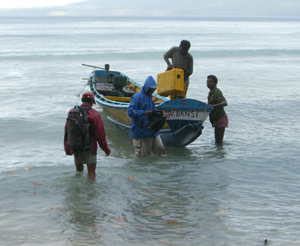
On the way to a GPS site in Andaman Islands
|
|||||||||||||||||||||||||||||||||||||||||||||||||||||||||||||||||||||||||||
|
|
|||||||||||||||||||||||||||||||||||||||||||||||||||||||||||||||||||||||||||
| 3890 Central Ave | Memphis TN 38152 | 901-678-2007 |