Beginning in 1998, the USGS initiated projects to address
high-resolution seismic hazard assessments in at-risk urban areas of
the U.S. This urban hazard mapping effort has been expanded in 2003 to
include the Tri-state Evansville area of Indiana, Kentucky, and
Illinois, as well as the St. Louis urban area of Missouri and Illinois.
In these new areas the USGS is serving more as a catalyst and
partner with local working groups.
|
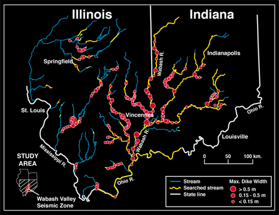
Map of sites in the Wabash Valley seismic
zone where liquefaction features (dikes) from prehistoric earthquakes
have
been documented.
In the Evansville area, the project is being lead by representatives
from the State Geologic Surveys of Kentucky, Illinois, and Indiana, the Southwest Indiana Disaster Resistant
Community Corp., the Central
U.S. Earthquake Consortium (CUSEC) emergency managers, CUSEC State Geologists, and the USGS.
|
Meetings
Initial planning workshop, 6/11/03
Filling in the project plan, 9/4/03
Working group meeting, 4/7/04
Advisory
Board Meeting, 5/13/04
News (Activities, New Products, Milestones)
 |
USGS,
Kentucky, Illinois, and
Indiana geologists & geophysicists meet to coordinate
field mapping, November, 2003.
|
Advisory
Board formed, convened 5/13/04!
Project Plan
|
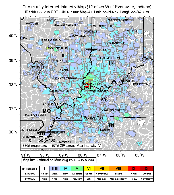
Map of shaking from a M4.6 earthquake that
occurred June 18, 2002 twelve miles west of Evansville, IN (from the
Central US 'Did You Feel It' USGS website at
http://pasadena.wr.usgs.gov/shake/cus/) |
Participants
|
|