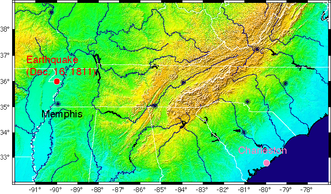
Figure — Topographic Relief map showing location of the Dec. 16, 1811 Earthquake in relation to Charleston, SC.
Three large earthquakes occurred in the New Madrid Seismic Zone (NMSZ) near the boot heel of Missourri in 1811 and 1812. Estimates of the magnitude of the earthquakes range from Mw 7.4 to 8.0. The earthquakes were large enough to ring the bell of St. Phillips Church in Charleston, SC. THe distance between the NMSZ and Charleston is nearly 1000 km (~660 miles).
The intent of this research is to first determine the level of ground motion required to ring the bell. The second step is then to determine the magnitude of an earthquake in the NMSZ required to produce that level of ground motion in Charleston.