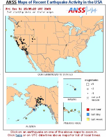
Automatically
generated, online map of earthquakes within the last 6 months shown at
a national scale. Regional scale maps also are available.
|
Latest earthquakes
in the CEUS
Map of
earthquakes that have occurred within the last hour to the last six
months in the central
and eastern USA. |
Latest
earthquakes in the USA and globally.
Maps
of earthquakes that have occurred within the last hour to the last six
months in
the USA and the world. |
|
Past earthquakes
globally
& regionally
Earthquake
maps, catalogs, and lists for significant earthquakes globally and by
region.
|
|
Did You Feel It?
Did you
feel an earthquake or want to know how it affected others? Select an
earthquake
from the list to view a map of how intensely other people felt it, and
submit
your own report.
|
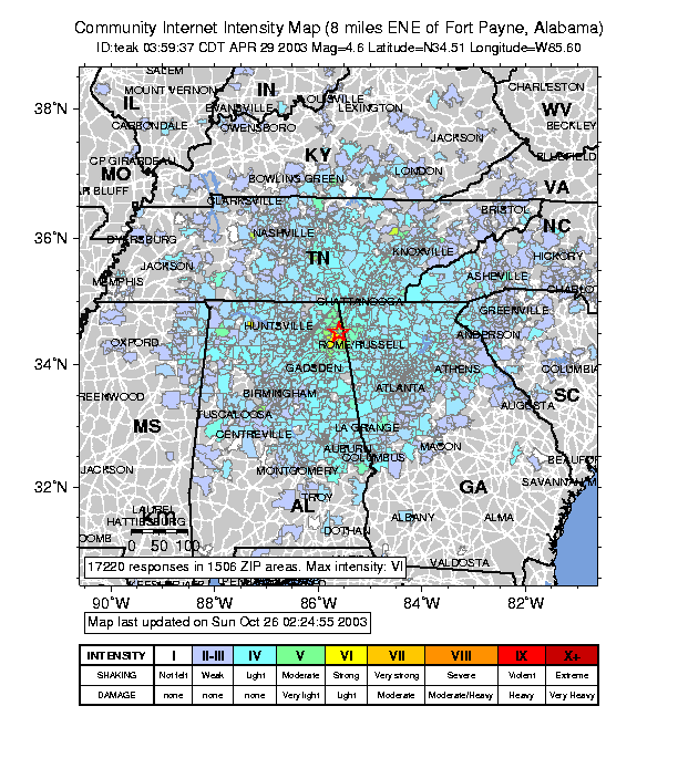
Automatically
generated map of the distribution of the effects of a M4.6 earthquake
near Fort Payne, Indiana. Based on public responses conveyed
through Web-based forms.
|
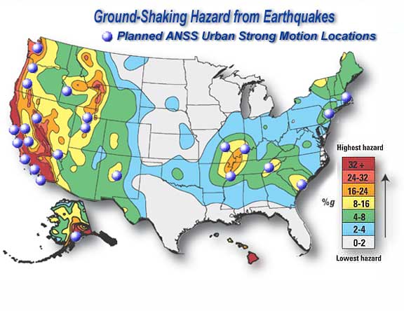 The ANSS will be a nationwide
network of at least 7000 shaking measurement systems, both on the
ground and in buildings. ANSS data will provide emergency
response personnel with real-time earthquake information, engineers
with information about building and site response,& scientists with
high-quality data to understand earthquake processes. The ANSS will be a nationwide
network of at least 7000 shaking measurement systems, both on the
ground and in buildings. ANSS data will provide emergency
response personnel with real-time earthquake information, engineers
with information about building and site response,& scientists with
high-quality data to understand earthquake processes. |
Advanced National
Seismic System
The goal
of the ANSS is to build a nationwide network of shaking measurement
systems, both
on the ground and in buildings. Such a system would provide emergency
response
personnel with real-time earthquake information, engineers with
information
about building and site response, and scientists with high quality data
to
understand earthquake processes and earth structure.
|
Earthquake
monitoring in
the Central & Eastern US
Earthquakes
in
the central and most of the eastern US are recorded by a system of
monitoring
networks operated by local and regional institutions. These networks in the
mid-America
region of the US work together to share information and
common
operational procedures under the umbrella of the growing Advanced
National
Seismic System. |
National
Strong Motion Program
This program has primary Federal responsibility for recording each
damaging earthquake in the United States. It maintains a national
cooperative instrumentation network, a national data center, and a data
analyses and research center. |