Beginning in 1998, the USGS initiated projects to address
high-resolution seismic hazard assessments in at-risk urban areas of
the U.S. This urban hazard mapping effort has been expanded in 2003 to
include the St. Louis area of Missouri and Illinois, as well as the
Evansville urban area of Indiana
and Kentucky. In these new areas the USGS is serving more as a
catalyst
and partner with local working groups.
|
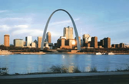
The dramatic Gateway Arch in St. Louis,
Missouri, towers over the gentle landscape of the central Mississippi
Valley.
In the past, this region has been struck by very powerful earthquakes;
the
Arch has been built to withstand earthquake shaking. (Photograph
copyright
Richard Sprengeler, courtesy National Park Service.)
In the St. Louis area, the project is being lead by representatives
from the University
of Missouri-Rolla Natural Hazards Institute, the Illinois State
Geological Survey, the Missouri
Dept. of Natural Resources, the Central U.S. Earthquake Consortium (CUSEC)
emergency managers, CUSEC State Geologists, and the USGS.
|
Meetings
Initial planning workshop, 6/09/03
Filling in the project plan, 9/3/03
Planning
meeting, 04/01/04
News (Activities, New Products, Milestones)
- Mapping announced during Earthquake Awareness
Week, at the St. Louis Science Center, February,
2004!
Project Plan
|
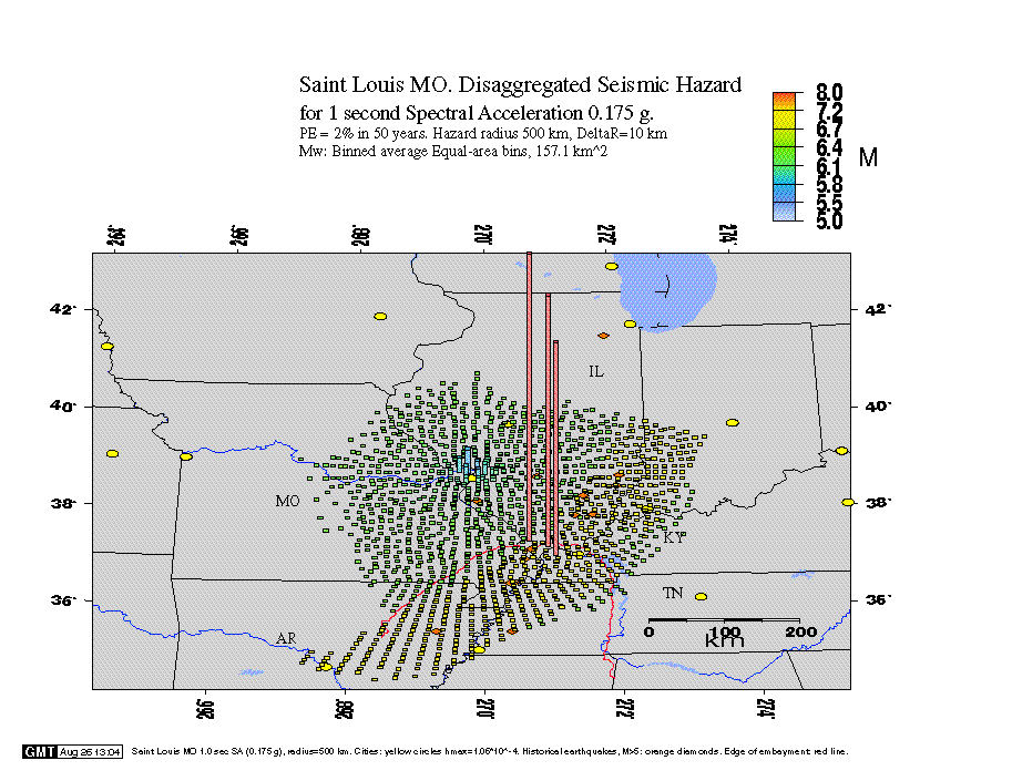
'Deaggregated' hazard at St. Louis, showing
the geographic locations at which significant sources of seismic hazard
are concentrated. The hazard, i.e., the annual rate of ground motion
exceedances, is computed for all sources (all
magnitudes) surrounding the city. The color of the bar over
each location indicates the average magnitude of all potential
seismic sources at that location. The height of the bar is
proportional to the sum of hazards from all sources at the
location. From the USGS webpage at
http://geohazards.cr.usgs.gov/eq/html/deagg_exp.html.
|
Participants
|
|