Urban Seismic Hazard Maps
These new types
of maps and derivative products build on the National Seismic Hazard Maps,
but also include the amplifying and damping effects of the local geology,
soils, and sediments on ground shaking at a resolution appropriate for urban
and emergency response planning.
|
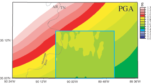
Probabilistic hazard maps showing ground
motions (peak ground accelerations) with a 2% probability
of being exceeded in 50 years. Inset map
of Memphis, Shelby County includes the effects of sediments, superimposed
on the larger national seismic hazard map that does not.
|
|
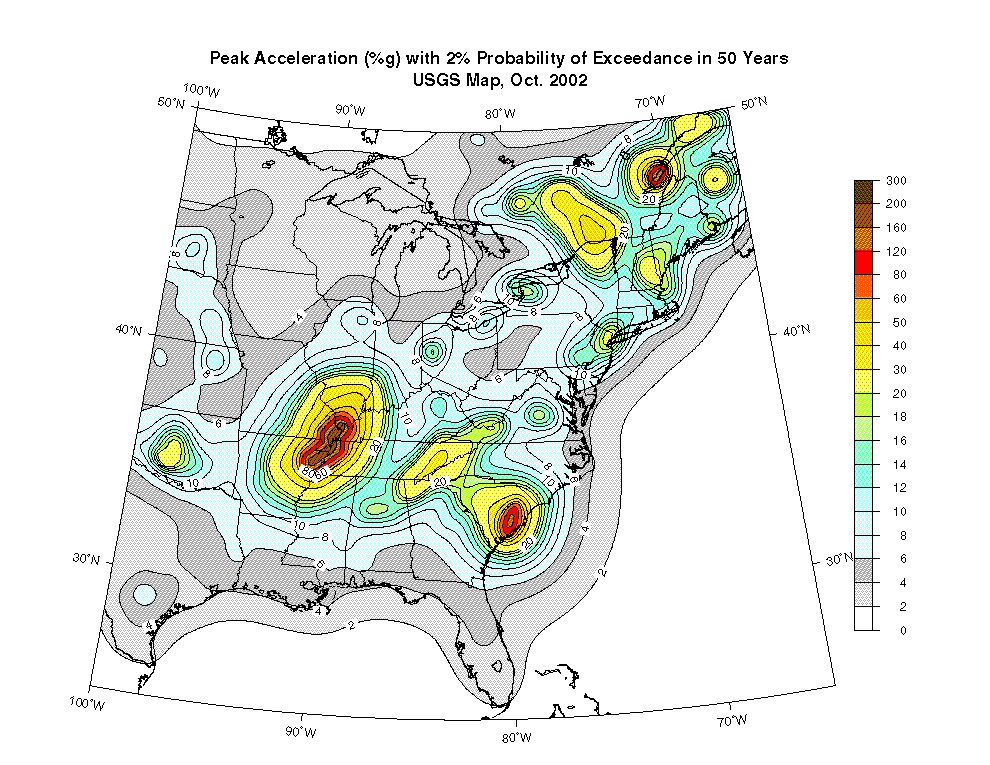
National Seismic Hazard Maps
Suite of USGS
maps and derivative products showing the shaking hazard for the entire US.
|
|
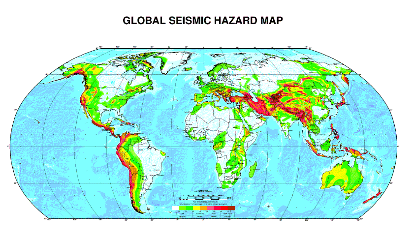
Global Seismic Hazard Maps
Maps showing
the shaking hazard for the world, compiled by a global consortium.
|
|
|
Welcome
to the U.S. Geological Survey Earthquake Hazards Program Website
Information
on worldwide earthquake activity, earthquake science, and earthquake
hazard reduction.
|
Earthquake Hazards Program
National homepage
for the Earthquake Hazards Program at the USGS.
|
|
Shaking Hazard
Map Fact Sheet
Summary of what a seismic hazard map is, & how they're made and used.
|
|
Hazards in Perspective
USGS overview
on hazards associated with floods, earthquakes, tsunamis, volcanoes, landslides,
wildlife disease, wildfire.
|